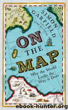
On The Map: Why the world looks the way it does by Garfield Simon

Author:Garfield, Simon [Garfield, Simon]
Language: eng
Format: epub, mobi
Publisher: Profile Books UK
Published: 2012-10-03T22:00:00+00:00
And there it sits on the map to this day, a long narrow slice of the lower half of the peninsula not far from the main body of the continent. The Bellingshausen Sea is there as well, but it buffets a westerly area around the largest Antarctic island that Bellingshausen could lay claim to, Alexander Island, which he named after the reigning Tsar.*
The prospect of unclaimed territory was an immensely appealing ambition for almost everyone who followed Palmer in the direction of the pole, and occasionally ambition undid them. Fans of the heroic age of Antarctic discovery will be familiar with the Weddell Sea, the treacherous area of drifting pack ice that crushed Shackleton’s Endurance in 1915. The man after whom it was named, the British Royal Navy sealing captain James Weddell, is not remembered by colleagues as a universally upright character (he failed to repay his loans), and in cartographic respects he appears to hover between unreliable and fraudulent. His map of 1825 appears to have been copied straight from Nathaniel Palmer, merely changing names to include his sponsors, colleagues or friends. So Spencer’s Strait became English Strait, Sartorius Island became Greenwich Island, and Gibbs Island became Narrow Island. These random transformations (there were more than twenty of them) remained on atlas maps for half a century.
There is also the suggestion that in the reports of his voyages Weddell deliberately overstated just how far south he had travelled, claiming he had sailed six degrees of latitude nearer the pole than anyone before him, apparently making the journey in clear sea without pack ice. The apparent ease of his passage inspired many subsequent navigators to plot a similar course, wherein they encountered only thick, impassable ice and were forced to turn back. Admiralty maps thus changed their description in the 1820s from ‘Sea of George the Fourth, navigable’ to merely Weddell Sea.
n
In 1838, the mapping of the continent received a welcome new scientific impetus. At the eighth meeting of the British Association For The Advancement of Science, a discussion was devoted to the dilemma of Terrestrial Magnetism, the pull of the earth’s magnetic force that had baffled sailors and their compasses for centuries. Those at the BAFTAS that year believed that Germany was leading the way in magnetic science, and, if unchecked, would lead to unfair dominance in the mapping, settling and trading of distant lands. So a committee was appointed, led by the indefatigable astronomer-photographer-botanist Sir John Herschel. Lord Melbourne, the Prime Minister, was to be kept continually informed, and it was recommended that a naval expedition depart for magnetic observations in the Antarctic seas. According to the meeting’s resolutions, the expedition was to focus specifically on the ‘horizontal direction, dip and intensity’, measured hourly. The further south these observations could be made, the better. But who, among the scientific and naval personnel at the disposal of Her Majesty’s Government, was up to this task?
Step forward Captain Sir James Clark Ross, a thirty-eight-year-old English naval officer, hooked on discovery since his teenage travels with his uncle Sir John Ross to find the Northwest Passage.
Download
On The Map: Why the world looks the way it does by Garfield Simon.mobi
This site does not store any files on its server. We only index and link to content provided by other sites. Please contact the content providers to delete copyright contents if any and email us, we'll remove relevant links or contents immediately.
| Africa | Americas |
| Arctic & Antarctica | Asia |
| Australia & Oceania | Europe |
| Middle East | Russia |
| United States | World |
| Ancient Civilizations | Military |
| Historical Study & Educational Resources |
Underground: A Human History of the Worlds Beneath Our Feet by Will Hunt(12073)
Sapiens by Yuval Noah Harari(5346)
Navigation and Map Reading by K Andrew(5142)
The Sympathizer by Viet Thanh Nguyen(4371)
Barron's AP Biology by Goldberg M.S. Deborah T(4132)
5 Steps to a 5 AP U.S. History, 2010-2011 Edition (5 Steps to a 5 on the Advanced Placement Examinations Series) by Armstrong Stephen(3714)
Three Women by Lisa Taddeo(3412)
Water by Ian Miller(3167)
The Comedians: Drunks, Thieves, Scoundrels, and the History of American Comedy by Nesteroff Kliph(3062)
Drugs Unlimited by Mike Power(2580)
A Short History of Drunkenness by Forsyth Mark(2276)
DarkMarket by Misha Glenny(2202)
The House of Government by Slezkine Yuri(2188)
And the Band Played On by Randy Shilts(2179)
The Library Book by Susan Orlean(2061)
Revived (Cat Patrick) by Cat Patrick(1983)
The Woman Who Smashed Codes by Jason Fagone(1955)
The Absolutely True Diary of a Part-Time Indian by Sherman Alexie(1898)
Birth by Tina Cassidy(1898)
